Air Transport System
Air Transport System
Abschlussbedingungen
Anzeigen
In this section, you will learn more about the air
transport system. The air transport system will
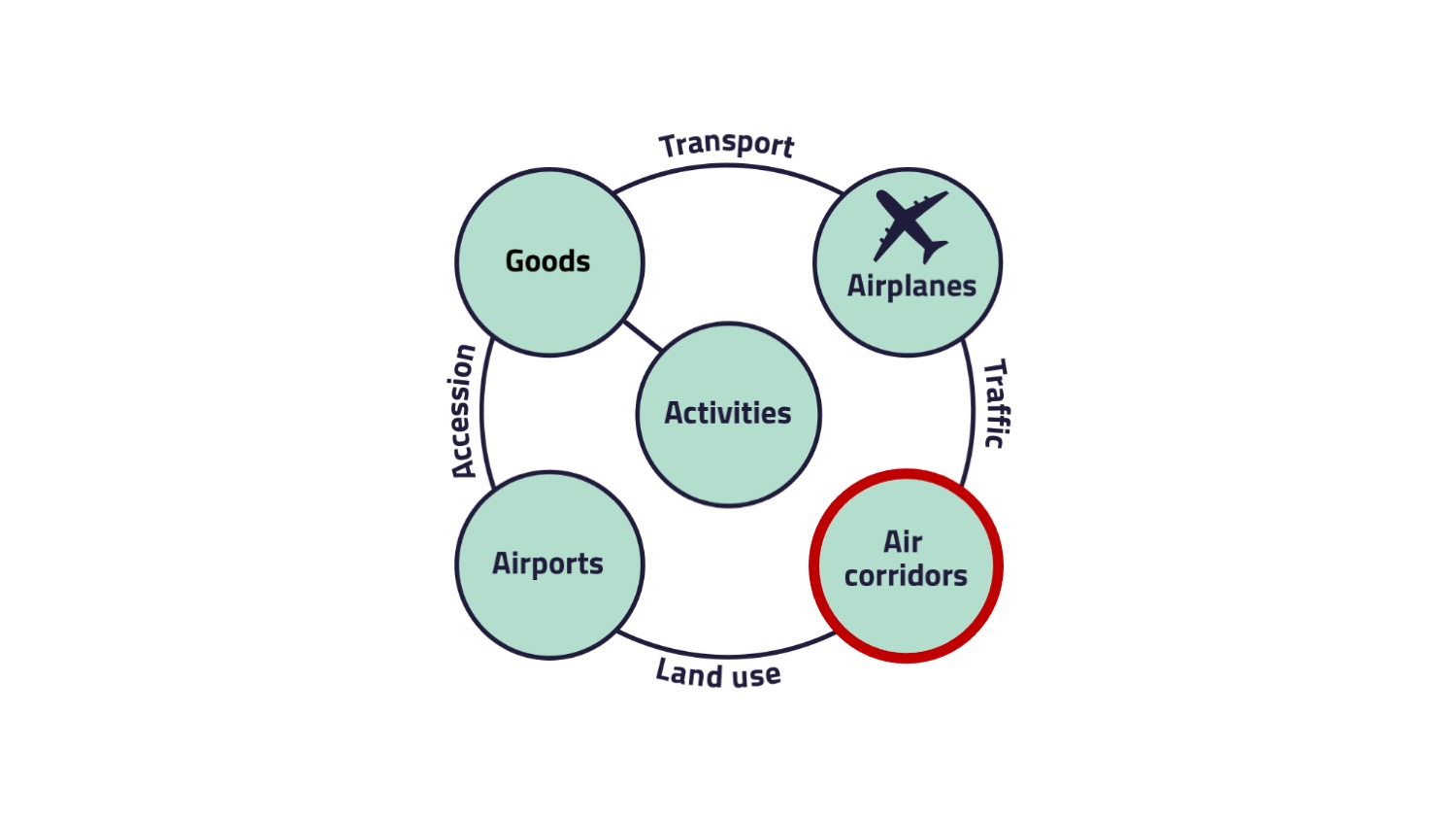
be presented according to the structure of the conceptual system model of transport and traffic.
You will learn more about the goods, being
transported by air, the different kind of airplanes, used air corridors
and airports.
5. Air corridors
This page will deal with the element „Infrastructure“ of the conceptual system model of transport and traffic.
In case of the air transport system, air corridors are the underlying infrastructure that is used to transport goods from A to B.

The flight path needs to be planned in advance. Aircrafts use different airspace classes depending on the type of aircraft and the distance flown. These airspace classes differ in terms of existing specifications.
Air space structure
Air space structure
In aeronautics, airspaces are the portion of the atmosphere controlled by a country above its territory. The International Civil Aviation Organization (ICAO) has defined an airspace structure with different airspace classes from A (Alfa) to G (Golf). The use of these classes depends on the country. Airspace classes A and B are not being used in Germany. The distinction between the classes is roughly made by the type of control of these airspaces (controlled/uncontrolled airspace) and includes broad guidelines for flying through these areas. The control of the different airspace classes is carried out by the air traffic control (ATC). Pilots must follow the instructions of ATC, who specify in which airspace class may be flown.
Own course suggestions can be considered by ATC.
The following figure shows the different airspace classes.
The following figure shows the different airspace classes.
Abbreviations
AGL: Above ground level
AMSL: Above mean sea level
FL: Flight level
AMSL: Above mean sea level
FL: Flight level
MSL: Mean sea level
Air Navigation Services are used to ensure safe air traffic.
Air Navigation Services (ANS) includes air traffic services, communication, navigation and surveillance services, meteorological services for air navigation and aeronautical information services. The objectives of ANS are to:
- prevent collisions between aircraft;
- prevent collisions between aircraft on the maneuvering area and obstructions on that area; note that this objective does not include the apron and ANS in general is not intended to prevent collision with terrain.
- expedite and maintain an orderly flow of air traffic;
- provide advice and information useful for the safe and efficient conduct of flights;
- notify appropriate organizations regarding aircraft in need of search and rescue aid, and assist such organizations as required.
The relation between the air corridors and airports is called land use.
Land use
Land use is the location of facilities at specific sites and is the combined result of public planning and complex market mechanisms. It may be seen as an interaction between a planned facility and infrastructure in its widest sense. This results in giving the facility a permanent address.
Literature
Literature
EASA (2018): What are Air Navigation Services (ANS) according to EASA? URL: https://www.easa.europa.eu/faq/45957 (last access: 30.03.2022).
Flämig, H., Sjöstedt, L., Hertel, C. (2002): Multimodal Transport: An Integrated Element for Last-Mile-Solutions? Proceedings, part 1; International Congress on Freight Transport Automation and Multimodality: Organisational and Technological Innovations. Delft, 23 & 24 May 2002. (modification of Sjöstedt 1996)
IFALPA (2019): Airspace Classification. URL: https://www.vcockpit.de/fileadmin/dokumente/themen/Airprox/19atsbl01-airspace-classification.pdf (last access: 30.03.2022).