Inland Waterway Transport System
| Website: | Hamburg Open Online University |
| Kurs: | MoGoLo - Mobility of Goods and Logistics Systems |
| Buch: | Inland Waterway Transport System |
| Gedruckt von: | Gast |
| Datum: | Sonntag, 26. Juli 2026, 04:15 |
Beschreibung
In this section you will learn more about the inland waterway transport system and
its different elements goods, vessels, inland waterways and ports.
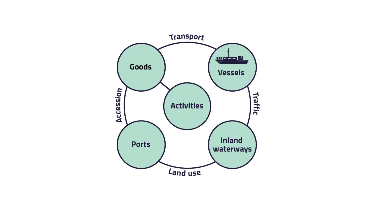
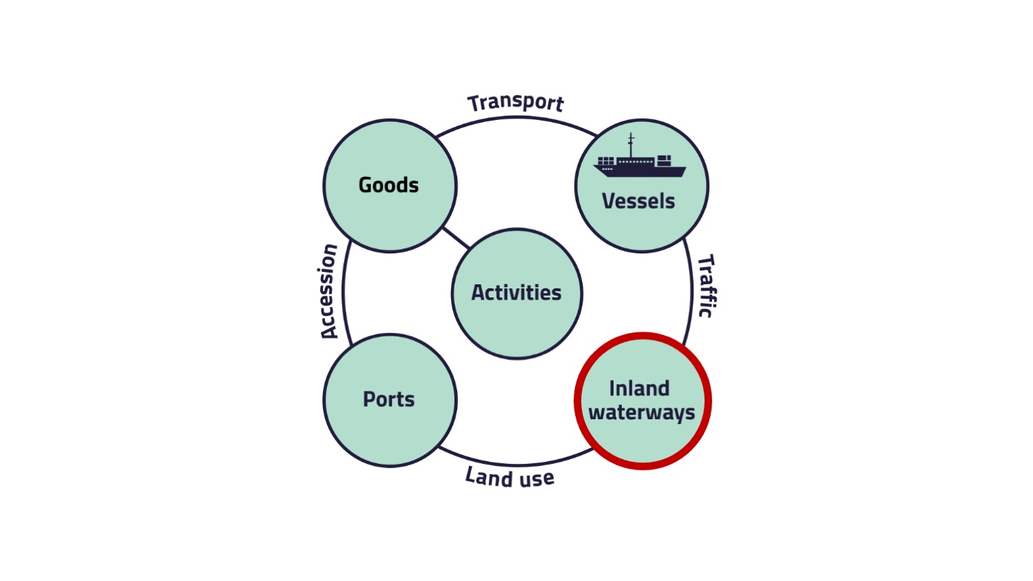
This topic follows the structure of the conceptual system model of
transport and traffic.
1. Introduction
In this section, you will learn more about the inland waterway transport system. You will get to know the activities that drive this system and the goods that are transported on inland waterways. You will then be introduced to the vessels used for transportation. In addition, the infrastructure of inland waterways and its port facilities will be explained. Finally, the advantages and disadvantages of inland waterway transport will be highlighted.
The section inland waterway transport system is also structured according to the conceptual system model of transport and traffic. For more information about this model, you can have a look at our topic Conceptual System Model of Transport and Traffic. The section Inland Waterway Transport System deals with the goods being transported on inland waterways. Furthermore, we will look at the different types of vessels and describe the inland waterway infrastructure in Germany and the effects of the network structure on expansion, optimization and operation. This section also explains the structure of ports and conducts a SWOT analysis of the ports. In the end, a short summary with the advantages and disadvantages will be given.
Literature
2. Activities
On this page, the element "Activities" is presented.
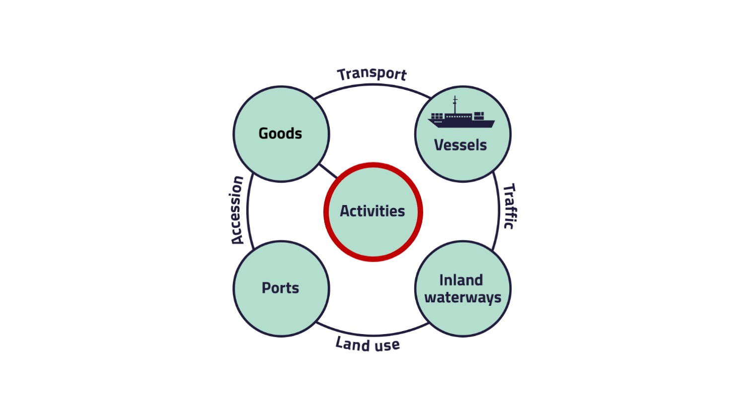
The two essential points are:
- We as consumer drive the system.
- The order is the steering medium.
After the activities, the goods need to be produced and transported afterwards, so we will introduce you to the goods on the next page.
3. Goods
One element of the conceptual system model deals with the types of goods, being typically transported with the presented mode of transport. We will show you on this page, what types of goods are typically transported and roughly what the demand is.
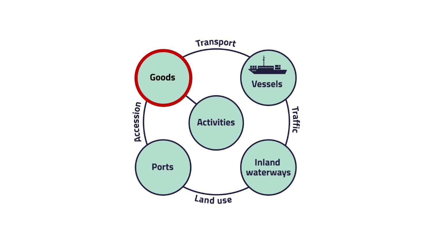
- metal ores and other mining and quarrying products, peat, uranium and thorium
- coke and refined petroleum products
- chemicals, chemical products and man-made fibers, rubber and plastic products, nuclear fuel and
- products of agriculture, hunting and forestry, fish and other fishing products.
The relation between goods and vessels is called transport.
Transport
Literature
Eurostat (2025): Goods transported by inland waterways. https://ec.europa.eu/eurostat/statistics-explained/index.php?title=Inland_waterway_transport_statistics#E2.80.98Metal_ores_and_other_mining_and_quarrying_products.E2.80.99_-_main_product_category_transported (Last access: 15.05.2025).
Flämig, H., Sjöstedt, L., Hertel, C. (2002): Multimodal Transport: An Integrated Element for Last-Mile-Solutions? Proceedings, part 1; International Congress on Freight Transport Automation and Multimodality: Organisational and Technological Innovations. Delft, 23 & 24 May 2002. (modification of Sjöstedt 1996)
3.1. Quiz - Typical goods for inland waterway transport
4. Vessels
On this page, the element "Vessels" is described in detail. Different types of vessels are used for inland waterway transport, depending on the type of goods and the quantity to be transported.
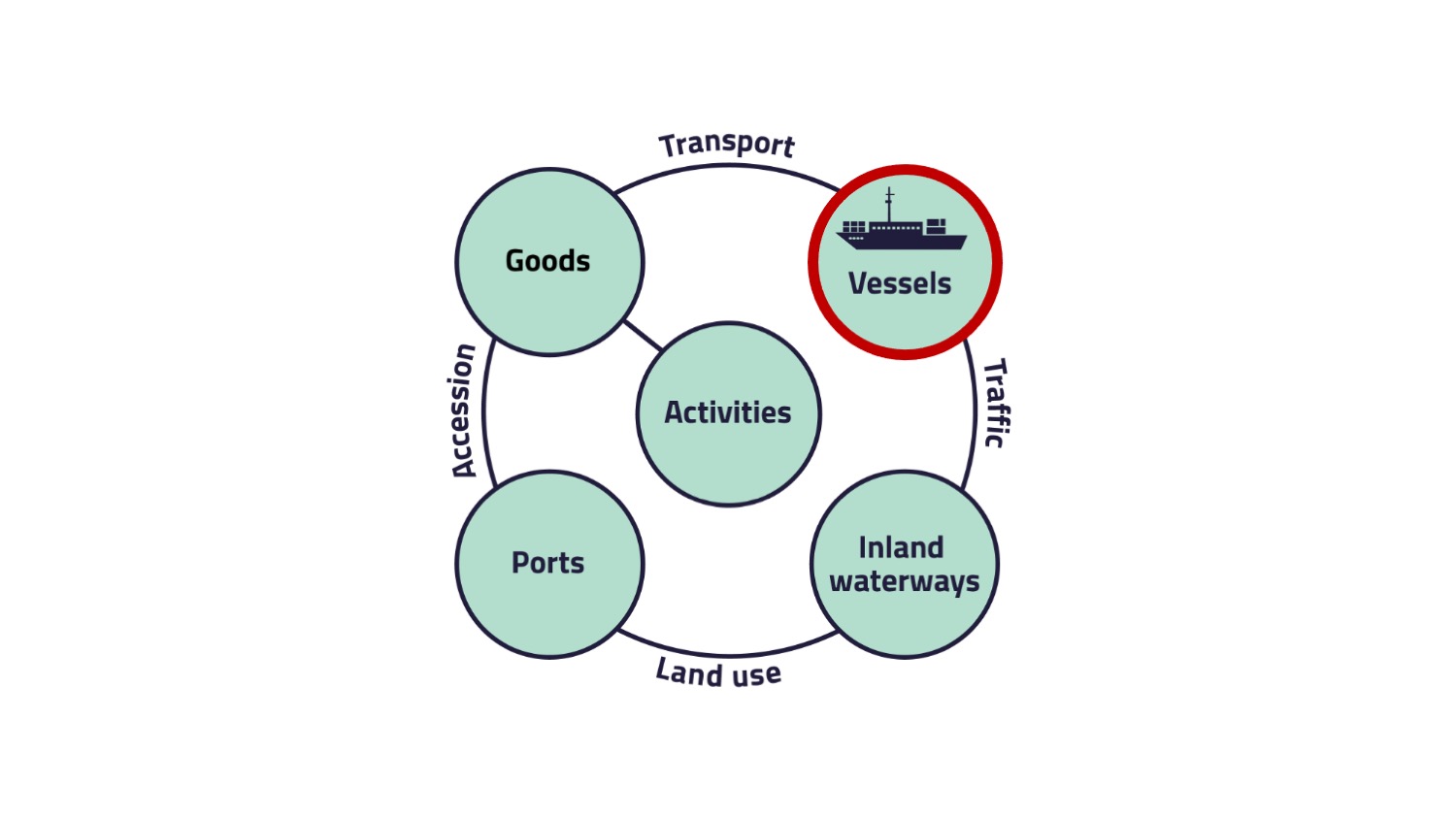
The figure "Types of barges" shows different types of barges used for the inland waterway transport.
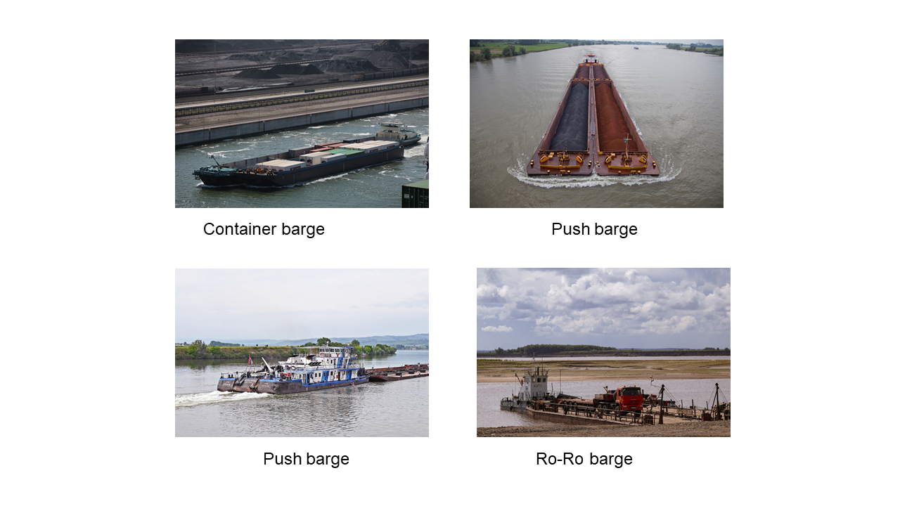
In comparison to the use of trucks for transport, an inland vessel has a much higher loading capacity. For example, a rather small ship with a loading capacity of 350 tons is about the same as the loading capacity of 14 trucks.
The longest type of inland vessels, the push barge, can have a loading capacity that is equivalent to 440 trucks.
Depending on the natural conditions and the used ship type, an inland container vessel with a capacity of 470 TEU can replace up to 470 trucks and a Ro-Ro Vessel up to 72 trucks, while a tank ship can replace up to 120 trucks.
We will now deal with the relation between vessels and inland waterway, called traffic.
Traffic
- In China, about 80 percent of inland waterway transport takes place on the Yangtse.
- In Germany, about 80 percent of inland waterway transport takes place on the Rhine.
Literature
Österreichische Wasserstraßen-Gesellschaft mbH (2007): Manual on Danube Navigation. URL: http://www.prodanube.eu/images/stories/downloads/Manual_Danube_Navigation_2007.pdf (last access: 30.03.2022).
Wasserstraßen und Schifffahrtsverwaltung des Bundes (2021b): Wasserstraße Rhein 2019/20 - Bilanz und Perspektiven. URL: https://www.gdws.wsv.bund.de/SharedDocs/Pressemitteilungen/DE/20210421_Wasserstrasse_Rhein_2019_2020_PM.html (last access: 30.03.2022).
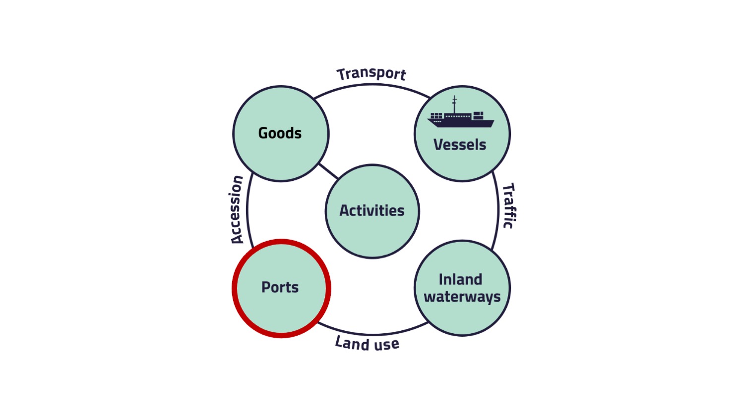
5. Inland Waterways
Now we deal with the element infrastructure of the conceptual system model, which is in the case of the inland waterway transport system represented by the "Inland waterways".
- canals,
- rivers,
- lakes or
- between inland ports and wharves.
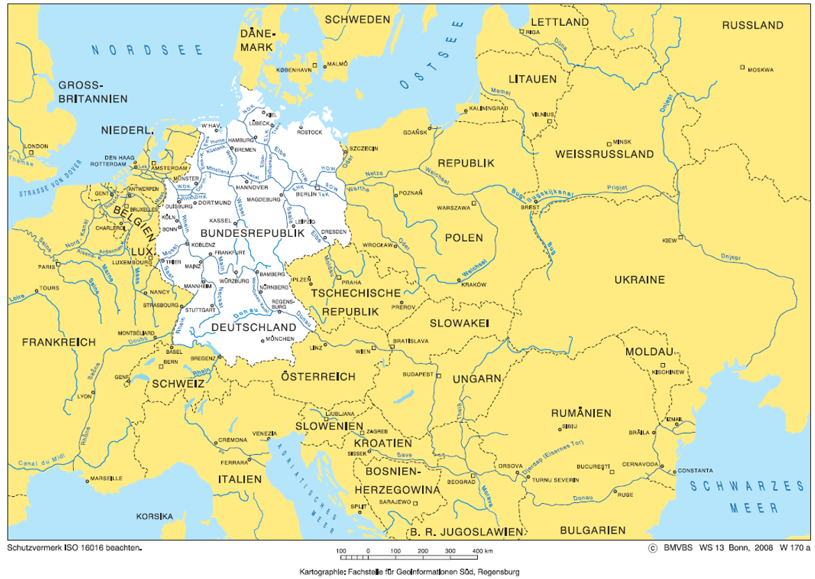
European inland waterways
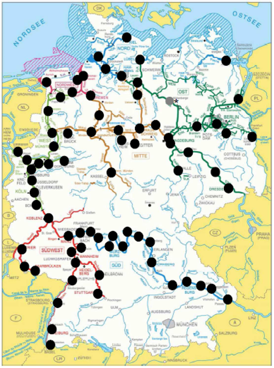
The picture "Waterway network in Europe" gives you a rough overview of the waterway network in Europe.
German waterway network
German inland waterway priority network
- Available resources (material, personnel) will be focused on sections of the waterway infrastructure with already or anticipated heavy traffic.
- Processes and technology should be further standardized and pooled.
- Third parties should be more involved in the task execution (especially for waterways with low traffic importance).
- Shifting freight transport to inland waterways.
The figure "Waterway network Germany" shows the different waterway networks in Germany.
One network criteria is defined by the scope of the use of a waterway in terms of the annual transport capacity in tonnes. The criteria is based on the transport capacity in 2009 and the forecast of the traffic development until 2025.
The waterways in Germany are divided into different classes depending on their transport volumes. For example on the priority network (red), more than 10 mio. tons are transported, while in the edge network (blue) only more than 0.1 mio. tons are transported.
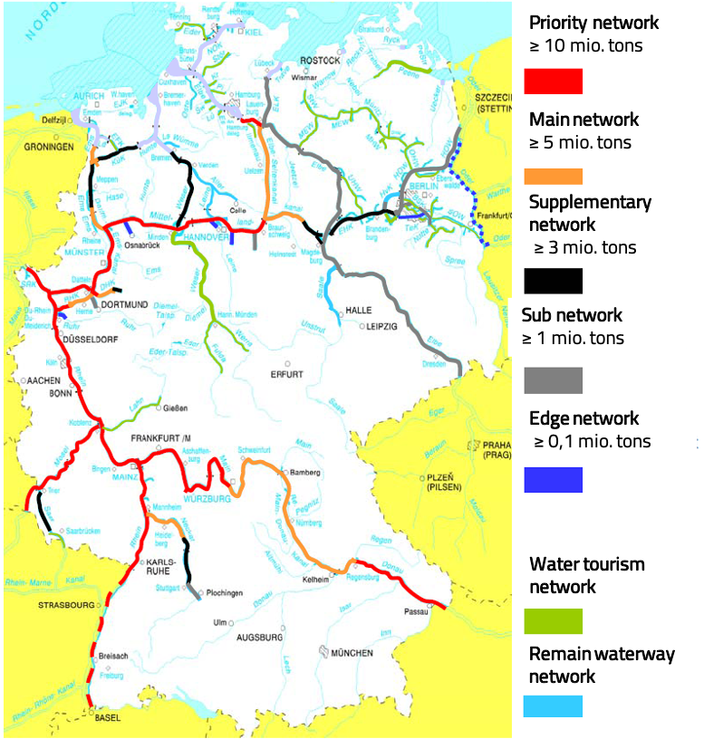
- priority network: ≥ 10 mio. tons of cargo per year
- main network: ≥ 5 mio. tons of cargo per year
- supplementary network: ≥ 3 mio. tons of cargo per year
- sub network: ≥ 1 mio. tons of cargo per year
- edge network: ≥ 0,1 mio. tons of cargo per year
Impact of network structure on expansion, optimization and operation
There are different strategies for the future development of the inland waterway depending on its category. While the priority network should be expanded with high intensity, the main and the supplementary waterway network should only be optimized with different intensities. The sub waterway network is expanded and optimized with low intensity, meaning that the efforts are not too high for this category. Tasks to expand and optimize the edge and remain waterway network are not perceived anymore. The category also influences the traffic related financing and operation. The traffic related financing and traffic related operation are pursued with high intensity (higher than before 2011) for the priority and main waterway network and with the same intensity as in 2011 for the supplementary and sub waterway network. For the edge and remaining waterway network the intensity is low or tasks are not perceived anymore.
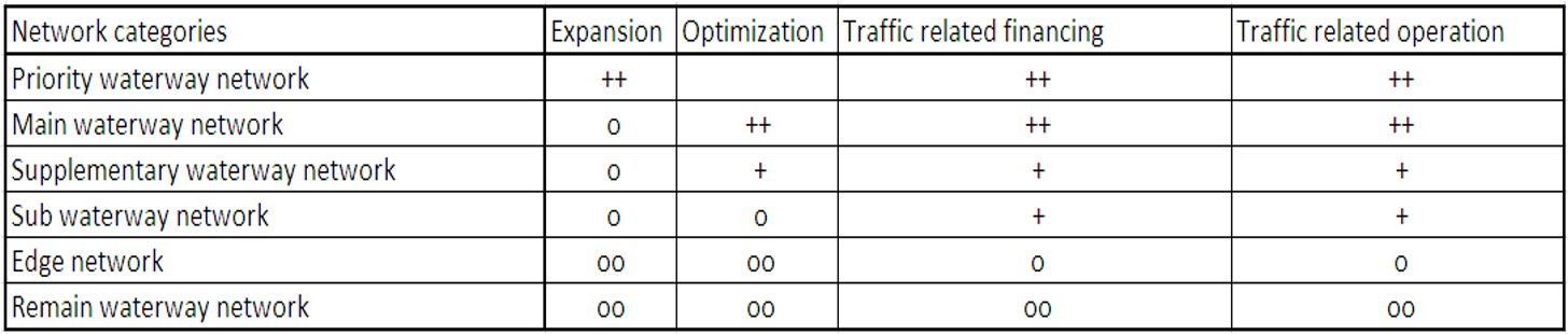
++ high intensity
+ same intensity
o low intensity
oo task is not perceived anymore
Extension of the priority network:
- Construction of German waterways and hydraulic engineering sites enable the navigability for much larger vessels.
- e. g. new locks, continuously enlarging and deepening of waterways
- All measures to improve the conditions of navigation.
- e. g. bridge lifting, adjustment of curve radii
- All temporary and permanent conservation measures of the waterway.
- All measures for the maintaining of navigation on the waterways.
Many important economic centers have a direct connection to the inland waterway network and use it for the transport of goods.
A study by Koch, Mahler and Stumpf (2012) defined alternative evaluation criteria's of the German waterway network. In their study, they defined economic centers, evaluated the waterways and categorized the German waterway network.
Define economic centers
- More than 10.000 employees in the producing industry.
- A minimum turnover of 1 billion € at the producing industry.
- An Inland Port or a private transshipment point.
Categorization of the German waterway network
- Core network (≥ 1.000.000 evaluated transportation units)
- Sub network (< 1.000.000 evaluated transportation units)
- Leisure time network (rest of the waterways)

- Connection between the zone of attraction of the rivers Seine and Schelde.
- Transport of goods between France, Belgium, the Netherlands and Germany.
- Construction from 2012 for opening in 2017; after the election it is put on hold.
- Starting again: 3rd of October 2017 for opening in 2030.
- length: 106 km
- width: 54 m
- depth of water: 4,5 m
- category: Vb
- Improvement of the competitiveness and attractiveness of the crossed regions.
- Connection of the French inland waterway to the European transport network.
- Reduction of road freight transport.
Land use
Literature
Flämig, H., Sjöstedt, L., Hertel, C. (2002): Multimodal Transport: An Integrated Element for Last-Mile-Solutions? Proceedings, part 1; International Congress on Freight Transport Automation and Multimodality: Organisational and Technological Innovations. Delft, 23 & 24 May 2002. (modification of Sjöstedt 1996)
Wasserstraßen- und Schifffahrtsverwaltung des Bundes (2022a): Bauwerke und Anlagen. URL:
https://www.gdws.wsv.bund.de/DE/wasserstrassen/02_bauwerke-anlagen/bauwerke-anlagen-node.html (last access: 30.03.2022).
Wasserstraßen- und Schifffahrtsverwaltung des Bundes (2022b): Bundeswasserstraßen.
URL: https://www.gdws.wsv.bund.de/DE/wasserstrassen/01_bundeswasserstrassen/bundeswasserstrassen-node.html (last access: 30.03.2022).
Wasserstraßen- und Schifffahrtsverwaltung des Bundes (2021b): Klassifizierung der Binnenwasserstraßen. URL: https://www.gdws.wsv.bund.de/DE/wasserstrassen/01_bundeswasserstrassen/Klassifizierung/Klassifizierung_node.html (last access: 30.03.2022).
6. Ports
In the inland waterway transport system, the facilities are called "Ports". Ports are the prerequisite to transport the goods on the inland waterway system.
Inland ports
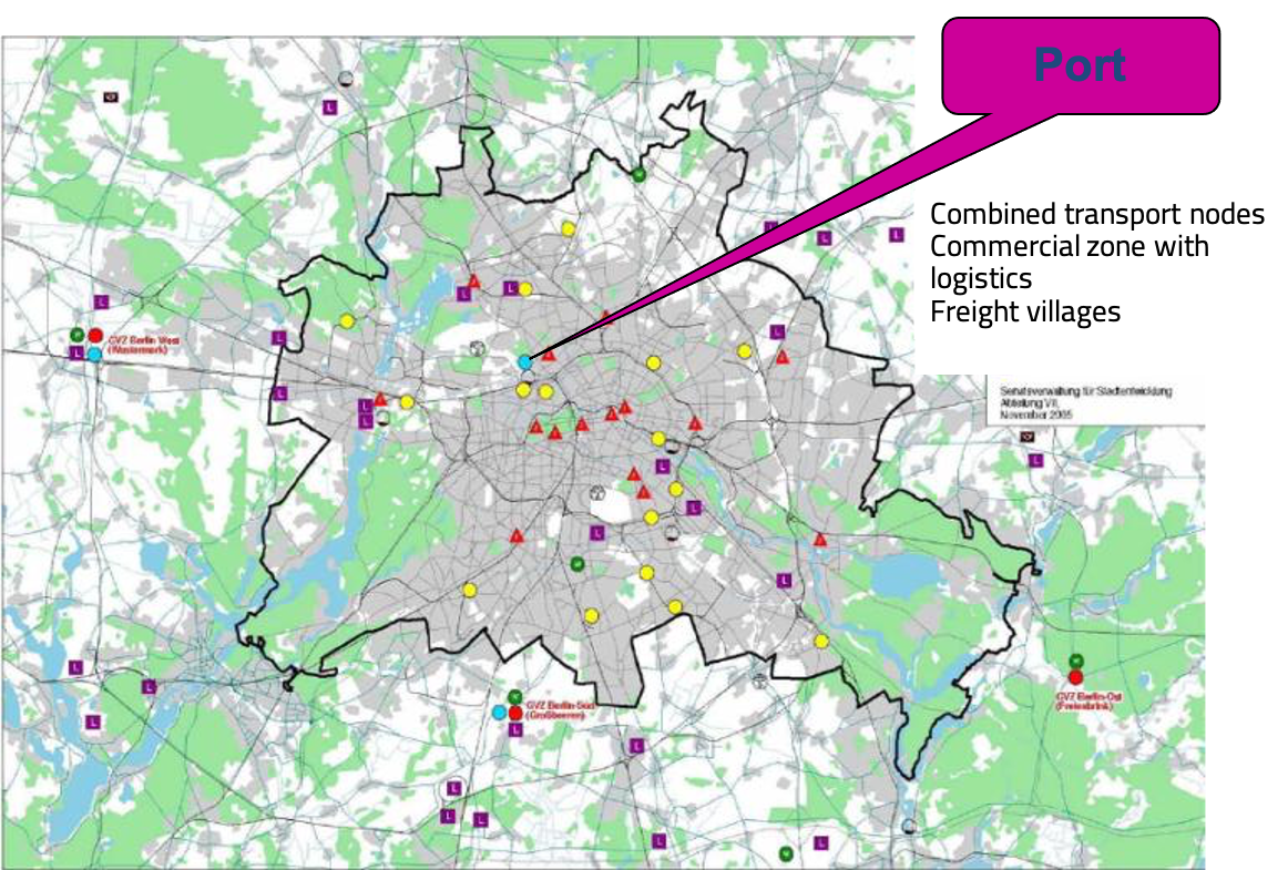
Inland ports still play an important role in the supply and disposal of the region and are (mostly trimodal) interfaces of the transport modes. They are confronted with numerous competing uses. In Germany there are about 1,200 port and transshipment sites, of which about 100 inland ports are public.
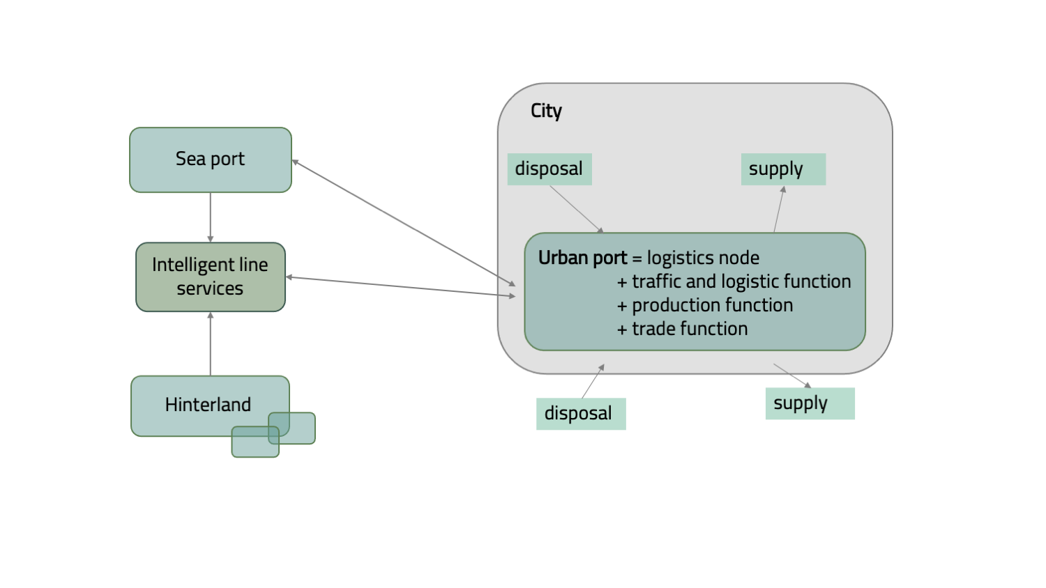
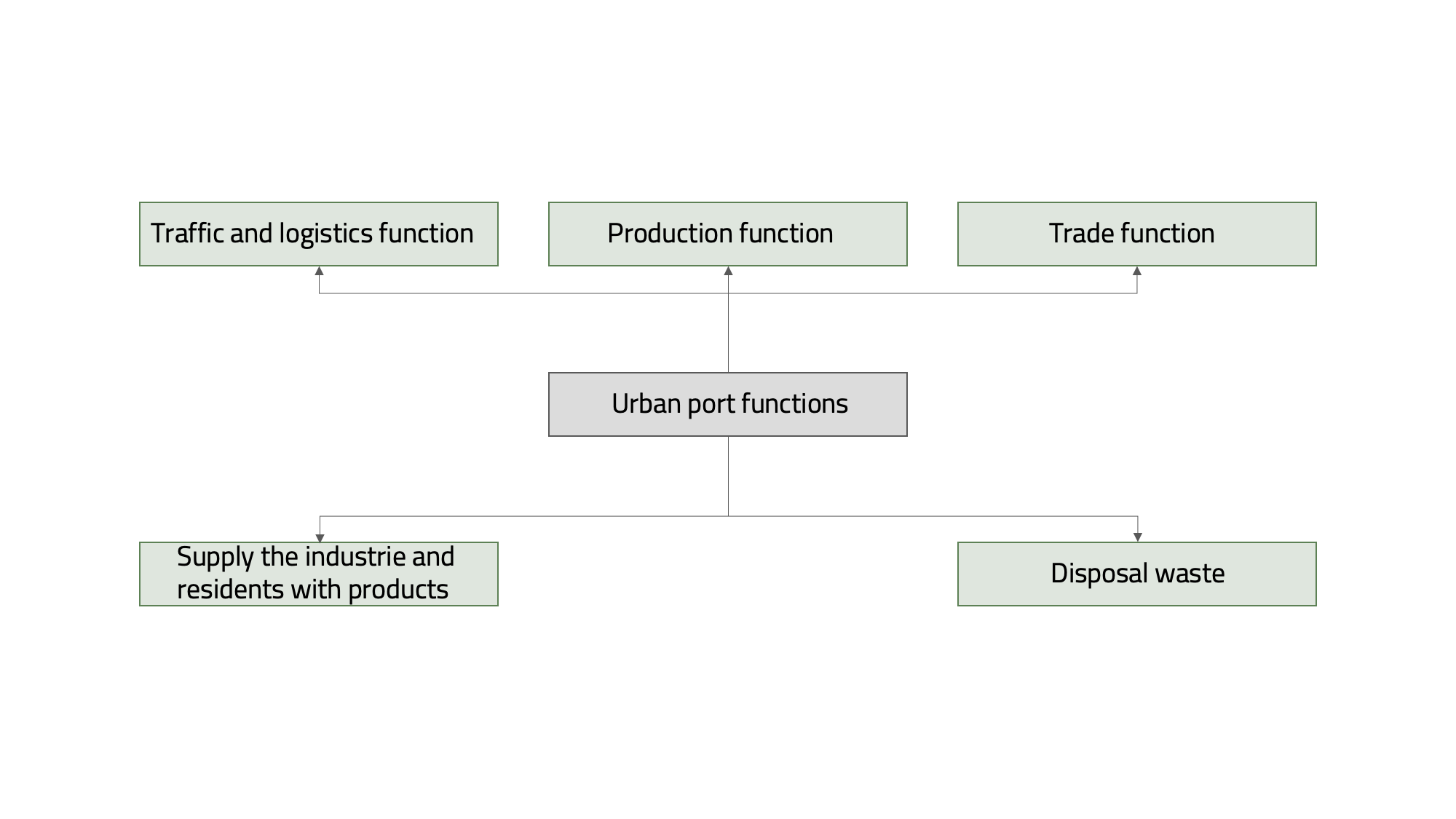
Urban port functions
An urban port has a lot of important and different functions. One function is the traffic and logistics function, so that the goods can be transported on the waterway, transferred from water to land and then send to the final destination. Some steps in the production of goods are executed directly at the port (production function). The same applies to the trade function, as a lot of trade is done directly at the port.
In addition to the inland ports Hamburg and Berlin, there are many other inland ports in Germany. A large number of them are located in the southwest of Germany. Many city terminals are located quite close to each other, forming different clusters.
The Westhafen port of Berlin is one best practice example of an urban port.
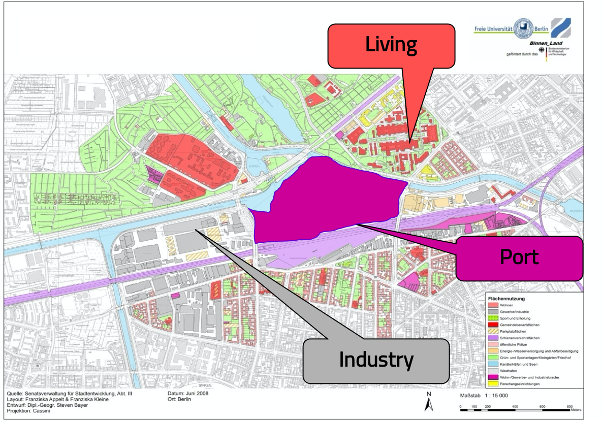
It is also interesting to know what the surroundings/land use of the port look/s like.
The image "Land use around the west port of Berlin" shows the different land uses in the port. The port is located directly on the waterfront and is surrounded by an industrial area on one side and residential areas on the other. This illustrates the difficulties of an urban port that must accommodate the needs of both industry and residents living near the port.
SWOT analyses are tools used for strategic planning. The goal of the detailed documentation is to analyze the strengths and weaknesses and opportunities and threats. Here we apply this to urban ports and look at their current position.
- tri-modal accessibility
- superstructure / equipment for tri-modal handling
- comprehensive range of services for handling, transportation and storage of break bulk, bulk, liquid and heavy cargo
- operator model provides one-stop services
- regional or local geographical integration
- integration of transport chain to relieve the seaports and land-based transport systems
- network integration (e.g. of terminal operators to bypass bottlenecks at the major gateways)
- enhanced awareness of inland ports by targeted public relations
- limited expandability due to missing land reserves (e.g. conservation area)
- lack of political support for the ports in the city and missing legal requirements (e.g. monument protection, immission)
- potential for conflict caused by emissions
- limited reliability of the water-side accessibility by low tide, locks, or something similar
- increased competition from road and rail in the same market segments (e.g. bulk cargo)
- structural adjustment and growth restrictions in the city ports by problems of acceptance and pressure of implementation („urban waterfront“)
- area bottlenecks
The relation between the elements goods and ports is called accession.
Accession
Flämig, H., Schulte, N. (2011a): Binnen_Land: Die Situation der Binnenhäfen und mögliche Handlungsstränge. Teil I des Abschlussberichtes zum Forschungsvorhaben. Band 6. Harburger Berichte zur Verkehrsplanung und Logistik.
Flämig, H., Schulte, N. (2011b): Binnen_Land: Kommunikation in der Binnenschifffahrt. Teil III des Abschlussberichtes zum Forschungsvorhaben. Band 8. Harburger Berichte zur Verkehrsplanung und Logistik.
6.1. Quiz - SWOT analysis for inland ports
It is good to know how SWOT analysis works because it is also used in many other areas. You might want to test yourself one last time in this chapter:
7. Summary
Since inland waterway transport is not as distinctive as transport by other modes, it may be interesting to know what speaks in favor of inland waterway transport and what speaks against it.
What speaks for the transport by inland vessels are the low transport costs and CO2-emissions. Compared to trucks, inland vessels can cover further distances with a much larger transport capacity. This makes them very efficient and could even relieve the roads and rails.
Some more reasons for and against inland waterway transport are listed below.
Reasons for inland waterway transport
- high single loading weights
- large transport capacity (economy of scale - high efficiency)
- processing of heavy goods traffic
- punctuality (no congestion) and reliability
- usually year-round navigability (365 days a year)
- wide range of special ships
- low transport costs
- safety transport
- environmentally friendly transport
- spare capacities
- no complete area coverage
- without own mooring place increased costs due to broken transport chains
- dependence on water level, ice drift and fog
- long transportation time
- inertia/backwardness in the system itself e.g. outdated technology
If you are interested in other modes of transport too, feel free to check our other topics maritime transport system, road transport system, rail transport system and air transport system.
Literature
Nuhn, H.; Hesse, M. (2006): Verkehrsgeographie, Schöningh Verlag, Paderborn.
Schulte, C. (1991): Logistik. Wege zur Optimierung des Material- und Informationsflusses. Verlag Franz Vahlen, München. pp. 64-65.
Wannenwetsch H.H. (2008): Transportsysteme. In: Intensivtraining Produktion, Einkauf, Logistik und Dienstleistung. Gabler, Wiesbaden.
7.1. Quiz - Advantages of inland waterway transport
Now that you've gotten a lot of information, feel free to check your knowledge level with this question:
8. Literature
Abgeordnetenhaus zu Berlin (2006): Stadtverträglicher Wirtschafts- und Güterverkehr in Berlin. Drs 15/4720
Bundesministerium für Verkehr und digitale Infrastruktur (2020): Verkehr in Zahlen 2020/2021. 49. Jahrgang, URL: https://www.bmvi.de/SharedDocs/DE/Publikationen/G/verkehr-in-zahlen-2020-pdf.pdf?__blob=publicationFile (last access: 30.03.2022)
Eurostat (2021): Inland waterway transport statistics. URL: https://ec.europa.eu/eurostat/statistics-explained/index.php?title=Inland_waterway_transport_statistics#E2.80.98Metal_ores_and_other_mining_and_quarrying_products.E2.80.99_-_main_product_category_transported (Last access: 30.03.2022)
Flämig, H., Schulte, N. (2011b): Binnen_Land: Kommunikation in der Binnenschifffahrt. Teil III des Abschlussberichtes zum Forschungsvorhaben. Band 8. Harburger Berichte zur Verkehrsplanung und Logistik.
Kruk, C.B.; Donner, M. (2009): Freight Transport for Development Toolkit: Ports & Waterborne Freight
Österreichische Wasserstraßen-Gesellschaft mbH (2007): Manual on Danube Navigation. URL: http://www.prodanube.eu/images/stories/downloads/Manual_Danube_Navigation_2007.pdf (last access: 30.03.2022)
Schulte, C. (1991): Logistik. Wege zur Optimierung des Material- und Informationsflusses. Verlag Franz Vahlen, München.
Wasserstraßen- und Schifffahrtsverwaltung des Bundes (2022a): Bauwerke und Anlagen. URL:
https://www.gdws.wsv.bund.de/DE/wasserstrassen/02_bauwerke-anlagen/bauwerke-anlagen-node.html (last access: 30.03.2022).
Wasserstraßen- und Schifffahrtsverwaltung des Bundes (2022b): Bundeswasserstraßen.
URL: https://www.gdws.wsv.bund.de/DE/wasserstrassen/01_bundeswasserstrassen/bundeswasserstrassen-node.html (last access: 30.03.2022).
Wasserstraßen- und Schifffahrtsverwaltung des Bundes (2021a): Klassifizierung der Binnenwasserstraßen. URL: https://www.gdws.wsv.bund.de/DE/wasserstrassen/01_bundeswasserstrassen/Klassifizierung/Klassifizierung_node.html (last access: 30.03.2022).
Wasserstraßen und Schifffahrtsverwaltung des Bundes (2021b): Wasserstraße Rhein 2019/20 - Bilanz und Perspektiven. URL: https://www.gdws.wsv.bund.de/SharedDocs/Pressemitteilungen/DE/20210421_Wasserstrasse_Rhein_2019_2020_PM.html (last access: 30.03.2022)